Search thousands of art pieces!

Get Email Newsletters
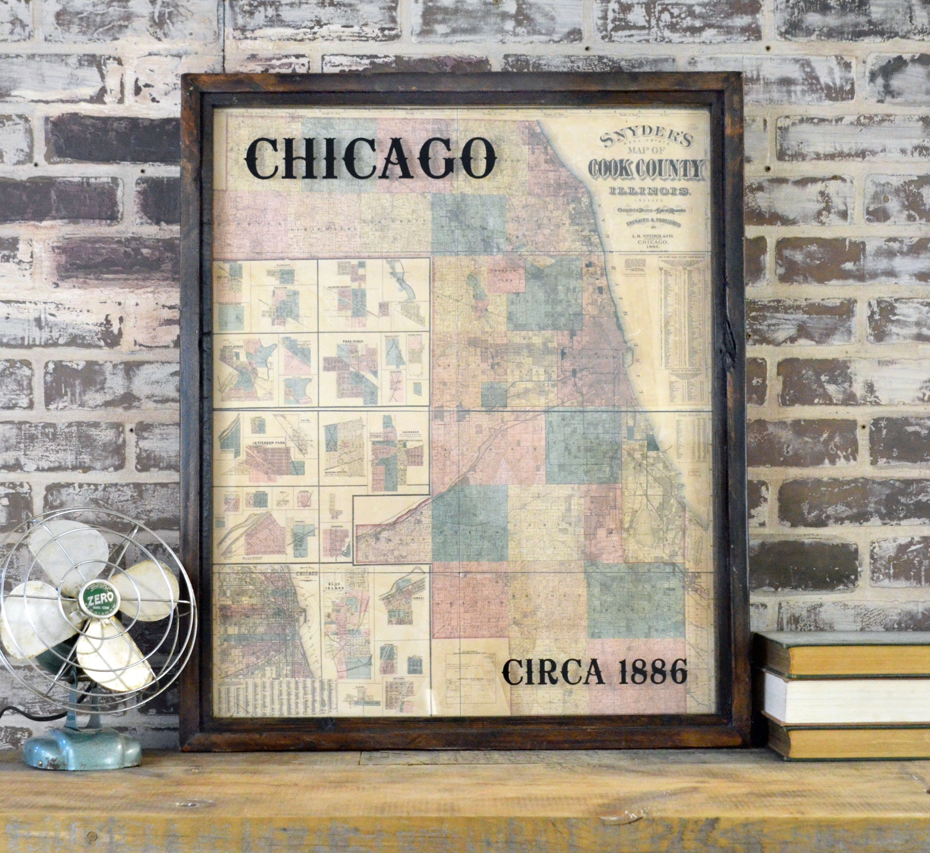
Chicago 1886 - Cook County Map
From the Amy Manning Gallery
From the Amy Manning Gallery
Category: Mixed Media & Collage
Title: Chicago 1886 - Cook County Map
Description: This newly printed 1886 Cook County map shows Chicago and the surrounding suburbs in great detail. Township divisions and landowner names are printed on this map, which also has insets of select towns along the left edge. The frame is made from reclaimed wood with a dark finish. The title and date are applied to the glass for a shadowbox effect. The map hangs with 2 D-rings mounted on the back upper corners. Add this piece of history to your home or office!
Theme: Maps
Color: dark brown, yellows and oranges, sage green, black
Surface: Board
Medium: 3D Collage
Dimensions: 25 inches wide, 31 inches tall, 2 inches as its depth
Shipping: $21.00
Price: $195.00